
NACIS 2020
Bike Mapping: Process and insights riding every single street in Huntsville
Presenters: David Nuttall and Ned Drummond
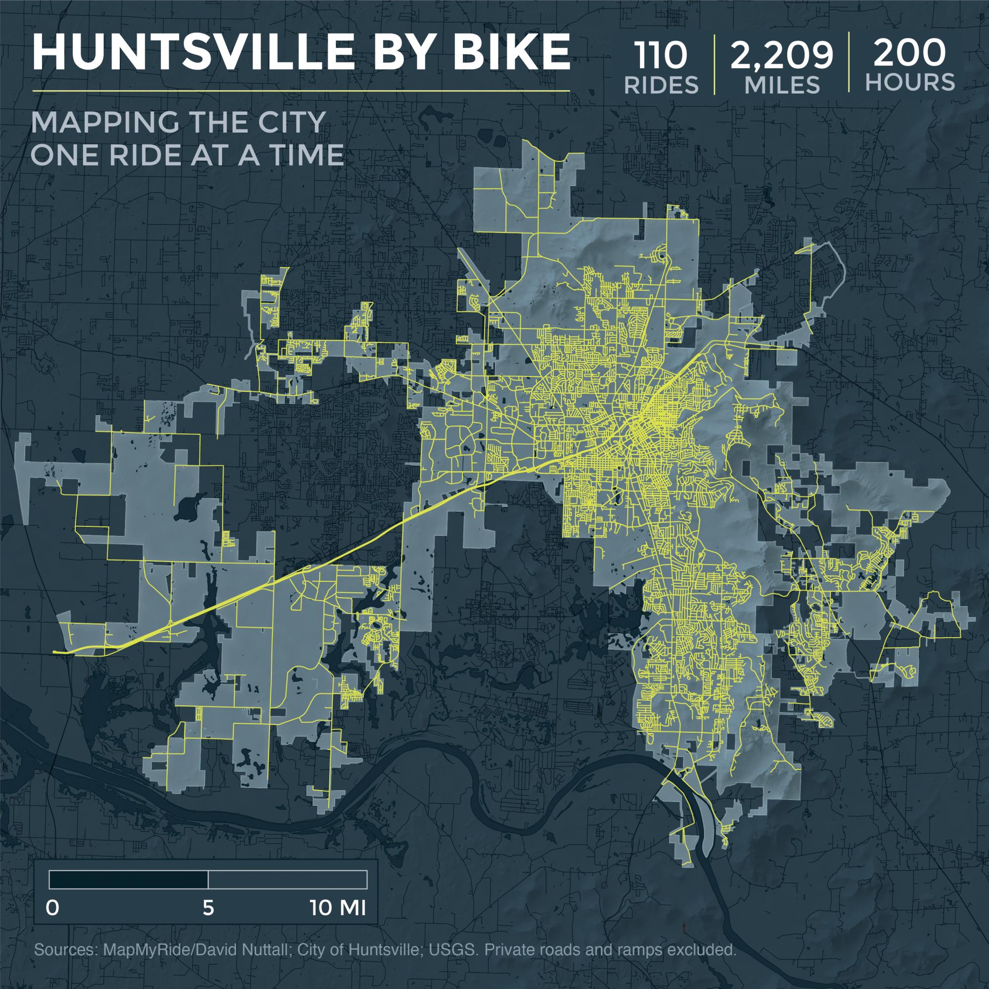
Mapping the City - One Ride at a Time
My "quest" to ride every single street withing the city limits of Huntsville, Alabama.
And to map the progress. Here are the final maps, created by by cartographer/designer friend Ned Drummond including the chronological annimated map of all rides.
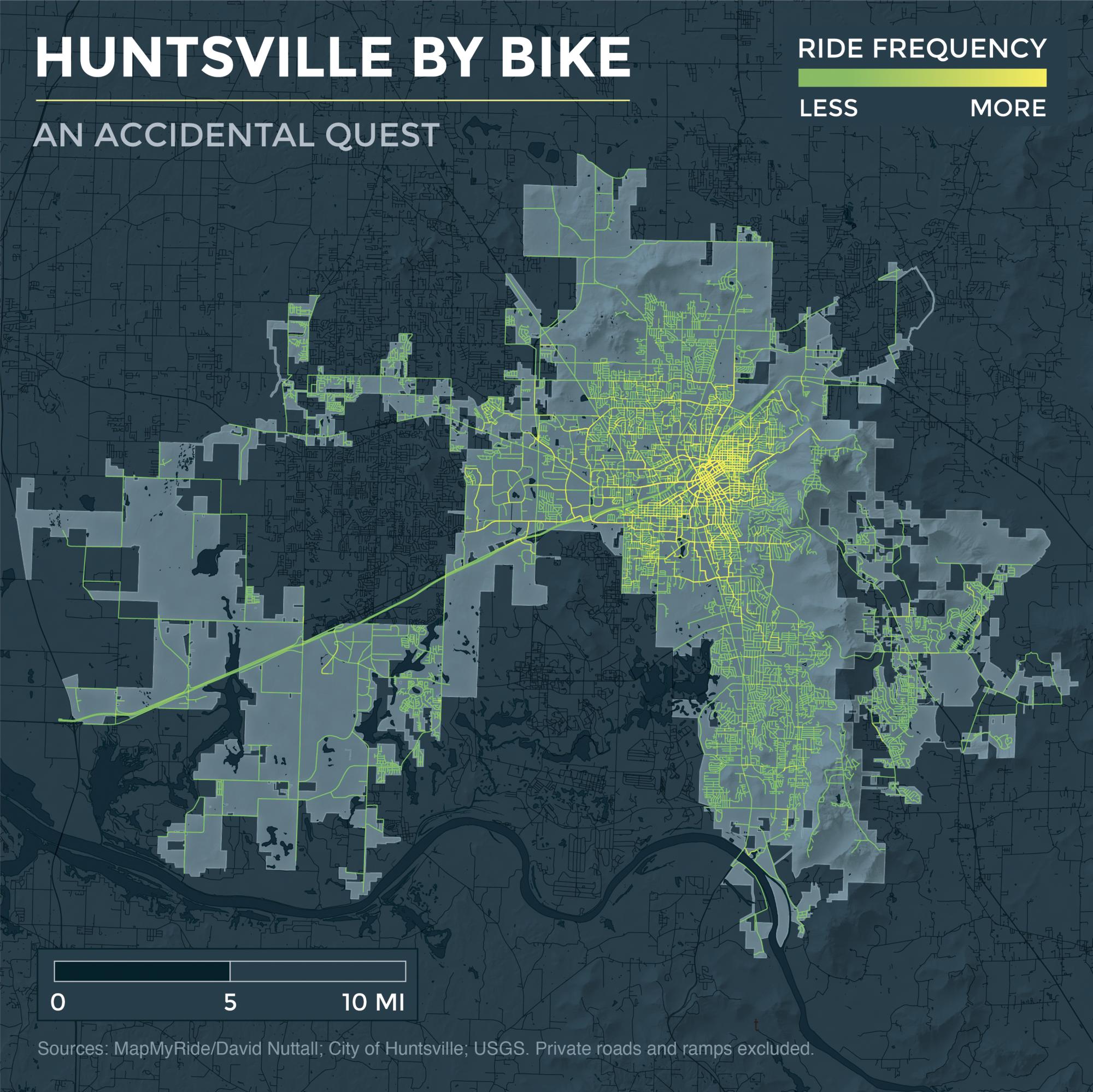
A rough density/frequency map showing how iniefficient a lot of the rides were, basically starting from my house each time in 2019.
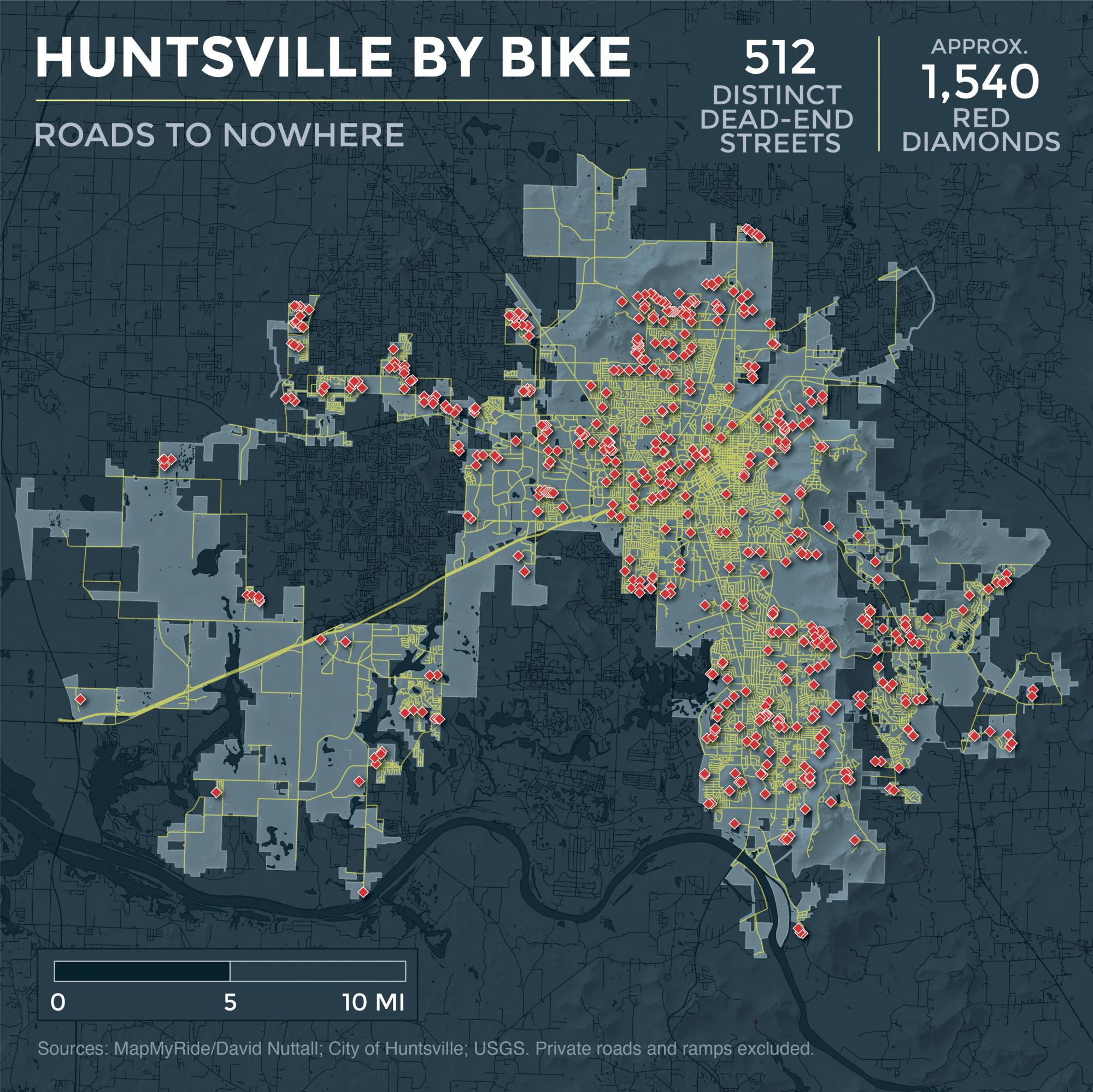
One of the main observations of the ride was discovering the number of streets that were dead end unfinished roads. Not cul-de-sacs or planned to end, but roads intended to continue, but were not finished.
Static version of the completed map, showing how large/sprawled Huntsville is (220 sq miles) and the interesting shape the city limits make.